
touch
Central Türkiye
Ihlara Valley in Cappadocia, Aksaray
The Ihlara Valley is an incredible gorge with a stunning river running right down the heart of the valley for 16 km within the volcanic rock. It’s a great spot for a relatively easy walk in peaceful, leafy nature. It’s also a hub for cave churches – you’ll come across many of them along the trail!
Ihlara Valley is near Mount Hasan and Mount Melendiz, two of the three volcanoes of Cappadocia. It has a depth of approximately 100 m and was formed by the Melendiz River thousands of years ago. It begins at the village of Ihlara and ends at Selime Monastery at the village of Selime after making 26 bends along 14 kilometers.
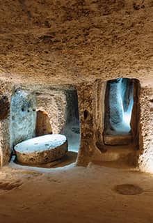
It is believed that the valley once housed more than 4,000 dwellings and 100 cave churches decorated with frescoes. Around 80,000 people once lived here.
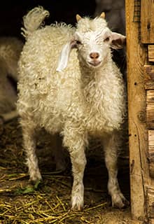
It is very pleasant to walk through the valley by the vineyards, poplars, and pistachio trees to the soothing sound of the rushing water of the Melendiz River, and surrounded by rich wildlife such as lizards, frogs, butterflies, birds, and sometimes eagles, and mammals like lamb and sheep.
There are numerous cave churches in Ihlara Valley. Most of them display scenes that are not similar to those depicted in Cappadocian churches but instead are reminiscent of the early churches of Syria and the Coptic churches of Egypt. However, the texts in the Ihlara churches are unusually long.
Unique Valleys in Cappadocia, Nevşehir
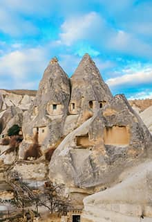
Devrent Valley, popularly known as Imaginary Valley and also as the Pine Valley, is one of top attractions to visit in Cappadocia. The small fairy chimneys in the valley form a lunar landscape, or moonscape, because of their peculiar shapes. The valley also has many animal shaped rocks that look like a sculpture zoo made by nature.
In Cappadocia, Paşabağ Valley is one which you should not miss. This beautiful valley is located on the road to Zelve while coming from Göreme or Avanos. In the middle of a vineyard, you can see remarkable earth pillars. The name Monks Valley was derived from some cones carved in tuff stones which stand apart even today.
Güvercinlik (Pigeon) Valley takes its name from the countless man-made dovecotes (Pigeon Houses) that have been carved into the soft volcanic tuff. Since ancient times Pigeons have been used in the Cappadocia region for food and fertiliser for the infertile soil. While pigeons no longer play such an important role in the area, their rocky homes have still been maintained by locals and can be found atop rock pillars and inside excavated cave houses and churches throughout the region.
Love Valley is home to some of the most impressive and breathtaking Fairy Chimneys in the Cappadocia region. The valley is scattered with hundreds of the thick, cone topped pillars that are an icon of the region. Formed over millennia by wind and rain erosion the remaining rock catches the sunlight and changes colours throughout the day. It's a paradise for photographers and geologists alike.
Red Rose Valley lies between the villages of Göreme and Çavuşin towns. The valley is layered with arched rocks in different hues of pastel pink, yellow and orange cliffs which are formed by volcanic eruption and wind and water erosion. Apart from its much-vaunted beauty, these valleys are a paradise for the hikers as there are many trekking trails.
Located in the Yeşilhisar district, Soğanlı Valley is counted among the most famous places to visit in Cappadocia. This valley is quite popular for its ancient historical sites, chapels, and monk cells. Once you explore the valley you will witness three pristine chapels named Karabaş Kilise, Yılanlı Kilise, and Saklı Kilise.
Tuz Gölü (Lake Salt) in Konya, Aksaray and Ankara
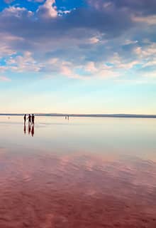
The Lake Tuz is the second largest lake in Türkiye after Lake Van. It is mainly fed by underground water. Being a tectonic originated site, the area is located in a closed large basin called Konya basin. The area is poor in inflowing rivers due to its location in the least rain fall receiving part of the country.
In summer, dry period dominates which results in the formation of a salt layer about 30 cm by means of excessive evaporation in the lake. It is one of the saltiest lakes of the world.
The Lake Tuz basin, which hosts an enormous variety of bird species, has approximately 6,000 bird nesting areas. In addition, it has been determined that 279 plant and bacterial species lived in the region. Salt Lake Special Environmental Protection Area, one of the important natural areas in the world, has been registered in the UNESCO World Heritage Temporary List due to these features.
The surface of the edges of the lake looks like an empty planet in which many visitors can perceive some oasis on the horizon. Over there a white layer covering the steppe plants mimics some sculpture shapes of the fine arts in nature.
Aladağlar National Park in Niğde, Kayseri and Adana
Aladağlar National Park is located at the intersection of the cities of Kayseri, Niğde and Adana. It is the home of the highest peaks of the Taurus Mountains range. The Aladağlar National Park is one of Türkiye's most intriguing locations from a geological point of view. The park is a favorite destination of climbers and welcomes many local and foreign climbing enthusiasts every year.
Between April and September, rafting is carried out on approximately 15 km of the Zamantı River. Caving, photo, jeep, and bicycle safaris, tour skiing, paragliding, rafting, canoeing, and hiking in the Aladağlar National Park are popular outdoor activities. The best time to visit Aladağlar if you are interested in sightseeing and climbing are June, July, and August.
Mount Erciyes in Kayseri
Located within the borders of Kayseri, Mount Erciyes is an inactive volcano. In antiquity it was known as “Argaeus.”
The mountain summit is formed by two peaks known as Little and Big Erciyes. Little Erciyes has an altitude of 2,700, and Big Erciyes’s altitude is 3,916 meters. The northern slopes of the mountain rise up to 2,700 meters.
The winter period on Erciyes begins on November and continues until May 1st. The Erciyes Ski Center, which opened in 2011, is located at an elevation of about 2,100 meters. The longest track is around 3,5 km long, and there are 14 mechanical lifts that take skiers up to various starting points. There are several hotels on the mountain that can accommodate a range of budgets.
In the summer, you can walk, have picnics, and barbecue on the mountain. Camping here is also very popular. Professional guides accompany trekkers across the mountain, exploring its beauty while peak climbing tours are also available. Other activities offered here include long-distance biking, mountain biking, or riding ATVs.
Transportation to the area is provided by car, bus, train, and intercity bus. Erciyes Mountain is 27 kilometers from Kayseri Erkilet Airport in Kayseri.
Kazankaya Canyon in Yozgat
Kazankaya Canyon is located near the town of Kazankaya, 10 kilometers from the district of Aydıncık near the city of Yozgat.
The canyon is 10 kilometers long. Alan Mountains, which are 1,363 meters high, are located south of the canyon, and Malbelen Hill sits in the west of the canyon. Çekerek River, a tributary of Yeşilırmak River, crosses through the canyon. On the canyon’s walls, there are ancient ruins, niches, and steps, as well as reliefs of the goddess Cybele, the Anatolian mother goddess, a symbol of abundance and fertility.
Mount Hasan in Aksaray
Mount Hasan, a volcanic mountain with a peak of 3,268 meters, attracts avid climbers and mountaineering enthusiasts with its imposing presence year-round. To climb the mountain, you need to head to the town of Helvadere via Aksaray, camp at the mountain's foot, and begin your ascent.
The Ancient City of Nora is located at the foot Mount Hasan. Those who would like to taste local fish, should look out for the restaurants next to the pond of Helvadere.
Mount Hasan also offers opportunities for winter sports. The best time for skiing is from December to April. Both amateur and professional athletes come here to paraglide.
Lake Beyşehir National Park in Konya
Several interesting Seljuk buildings are scattered around lovely Beyşehir found on the shores of the lake of the same name, Türkiye’s third largest lake. In the south-western region of the lake is the pristine wilderness of Lake Beyşehir National Park, Türkiye's second largest national park.
The reflection that appears at sunset in the lake creates eye-catching images with the boats on the lake tour. Green texture emerges at certain times of the year due to the reeds growing in the lake. For this reason, the lake turns green.
Ilgaz / Kırkpınar Plateau Recreation Area in Çankırı
The plateau is 70 km away from Çankırı and is located within the boundaries of the Ilgaz district. The plateau has an altitude of 1650 meters.
In the Kırkpınar Plateau, which has highland houses belonging to the surrounding villages, there is also a pond with an area of approximately 55,000 square meters.
Surrounded by yellow pine, larch, fir trees, and meadows, the plateau is very attractive with its easy access, exquisite scenery, clean air, and abundant water resources for those who want to engage in horseback riding and trekking, viewing, camping, caravan, photography, mountain hiking, apart from daily visitors.
Porsuk River and its Surroundings in Eskişehir
Eskişehir, is one of the rare cities in Türkiye with a river passing through it.
It is possible to take a gondola or boat tour on the Porsuk River. You can spend time in the cafes on the banks of the Porsuk River, in other words, "along the water" where you can play backgammon.
There are many places you can visit around Porsuk River. You can take a walk on Hamamyolu Street, which is closed to traffic, shop from pulse sellers and herbalists in Taşbaş, buy meerschaum souvenirs from Çukur Bazaar and see beautiful sculptures, sip your coffee next to Porsuk River, listen to street singers and have an evening walk in the impressive lighting of Reşadiye Mosque.

